A Surprisingly Useful AI Genealogy Trick: Searching Plat Maps
AI genealogy tools are often discussed in terms of writing summaries, generating reports, or helping analyze records. But one of the most practical and immediately useful applications is much simpler: using AI to visually search difficult historical documents.
A perfect example is old plat maps.
Anyone who has worked with historical land maps knows how tedious they can be to search manually. Names are printed in tiny text across hundreds of parcels, often on faded or low-resolution scans. Even when the map is fairly clear, finding a single family or landowner can require zooming in section by section and slowly scanning the entire page.
Recently, I was working with a historical Illinois plat map and wanted to know which Copelands appeared on it. More specifically, I was hoping to determine whether A. J. Copeland was present somewhere on the map and what nearby parcels or related Copeland families might also appear nearby.
Instead of manually searching the image myself, I uploaded the map into Google Gemini and simply asked:
“Can you find Copeland on here?”
That was the entire prompt. No advanced setup, no prompt engineering, and no special formatting.
In general, I prefer starting with very short and simple prompts like this. I would rather begin naturally and see what the AI can do before adding complexity. If the first attempt does not work well, then I expand the prompt from there and provide more detail or direction as needed. In this case, the simple approach worked surprisingly well.
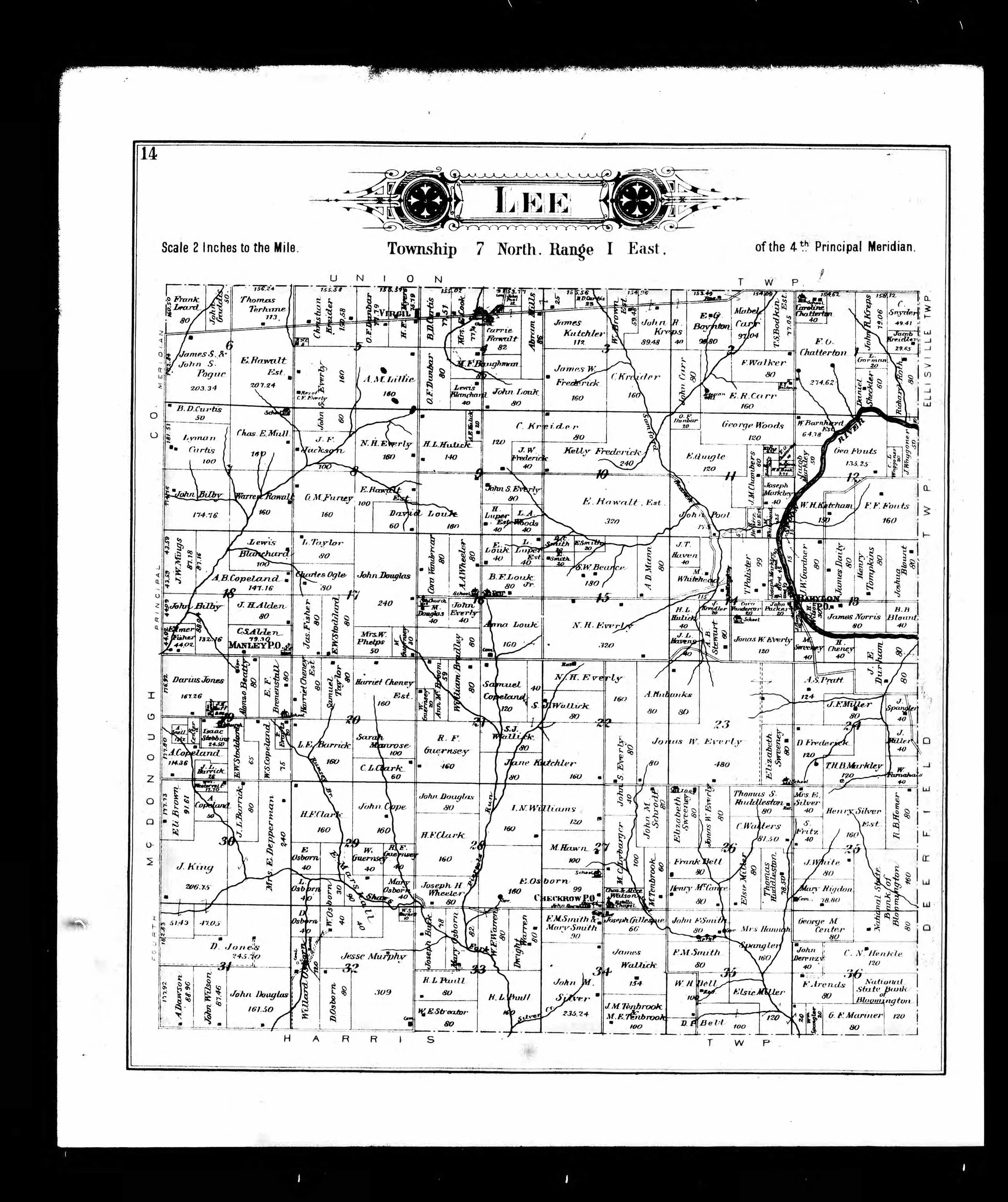
Lee Township, Fulton County, Map of 1895
The response was surprisingly good. Gemini identified several parcels associated with the Copeland surname and described where they appeared on the map, including references to nearby sections and landmarks. It pointed out A. B. Copeland in Section 17 near the Manley P.O. designation, Samuel Copeland in Section 20, and additional Copeland parcels along the western side of the township.
What impressed me most was not just that it found the names, but that it interpreted the structure of the map itself. It recognized township sections, parcel groupings, and relative locations in a way that would have taken considerably longer to work through manually.
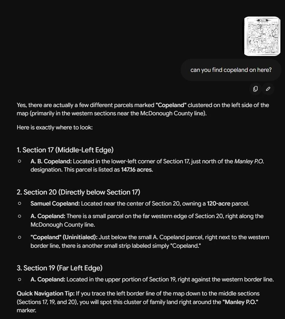
Gemini Output
This type of task is where AI currently shines for genealogy work. Historical documents often contain information that is technically visible but difficult for humans to process efficiently because of scale, density, or visual clutter. Plat maps, city directories, probate diagrams, cemetery maps, and land ownership atlases are all good examples. AI can act like a rapid visual assistant that scans the document and narrows the search area almost instantly.
Of course, the results still need to be verified manually. Historical maps contain faded text, unusual fonts, scanning artifacts, and overlapping labels that can cause reading mistakes. AI should not be treated as authoritative evidence. But even when imperfect, it can dramatically reduce the amount of time spent searching.
In this case, Gemini immediately directed me to the correct area of the map and identified multiple relevant parcels that I could then confirm myself by zooming into the original image.
This is an important distinction in how I think AI is most valuable in genealogy. The real strength is often not replacing analysis or making conclusions for you. Instead, it is helping you work through large volumes of historical material more efficiently so you can spend more time on actual research and interpretation.
And sometimes, the most useful AI prompts are also the simplest.